-

by
Jillian Pikora
Your Community
A powerful winter storm is set to bring hazardous travel conditions across Pennsylvania, prompting several school delays and closings, officials say.As of 10:00 p.m. Wednesday, Feb. 5, the following schools across the state announced closures or delays:ADAMS COUNTY (Closed):Bermudian Springs School DistrictConewago Valley School DistrictFairfield Area School DistrictGettysburg Area ...
-

by
Zak Failla
Weather
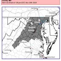
Maryland and Virginia residents are preparing for a possibly significant winter storm that is expected to deliver heavy snowfall and dangerously low temperatures starting Sunday afternoon according to the National Weather Service (NWS).Forecasters warn that snow accumulation in the region could range from four to eight inches, with the heaviest snowfall expected during the afternoon and ...
-
by
Zak Failla
Weather
Forecasters are cautioning that some wild weather may be moving through the DMV region through the weekend as the area braces for possible snow storms in parts of the area.A "Special Weather Statement" was issued by the National Weather Service advising that wind gusts possibly approaching 50 mph may be on the way on Wednesday night, bringing with it a strong cold front and possibly a ...
-
by
Cecilia Levine
Weather
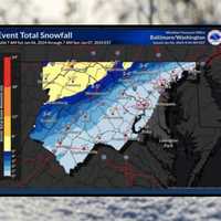
The highly-anticipated weekend storm is under way in the mid-Atlantic.But according to the National Weather Service, the worst is yet to come.A winter storm warning remains in effect until 7 p.m. from the Baltimore/Washington DC National Weather Service, who warned of slippery and dangerous road conditions through the evening.Sleet and freezing rain were arrived in northern Virginia and ...
-

by
Joe Lombardi
Weather
A new winter storm could bring a mix of snow, sleet, and rain that could cause slippery travel conditions in parts of the region.The time frame for the system is late Monday night, March 6 into Tuesday morning, March 7, according to the National Weather Service.But its projected track is uncertain.One forecast model is taking it a bit farther west. (See the image above from ...
-
by
Joe Gomez
Breaking News
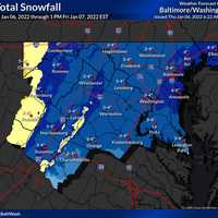
The National Weather Service has issued a Winter Weather Advisory for Maryland and Washington, DC, overnight.Total snow accumulations of 2 to 4 inches are possible with isolated high amounts of up to 6 inches in certain areas.The advisory begins at 9 p.m. on Jan. 6 and ends at 5 a.m. on Jan. 7. The heaviest snow is expected between 10:00 p.m. and 2:00 a.m. when snowfall rates of 1 inch ...
-

by
Valerie Musson
On Your Side
The roof of a Lehigh Valley bowling alley caved in due to snow accumulation Tuesday morning, causing severe damage, officials said.Police responding to a burglary alarm at Hampton Lanes on Main Street in Northampton found that the roof had completely collapsed just after 5 a.m., according to the county’s emergency alerts page.The family-owned bowling alley and restaurant — opened in ...
-

by
Joe Lombardi
Weather
A bitterly cold and blustery weekend will be followed by a potentially significant winter storm early next week.The current time frame for the storm has shifted from Monday night, Jan. 25 into Tuesday morning, Jan. 26 to Tuesday morning into Tuesday evening.Current models show an increasing likelihood of between 1 and 3 inches of accumulation for most of the region, with the potential ...
-

by
Joe Lombardi
Weather
A complex storm system that will sweep through the area starting with rain will change over to snow with accumulations of up to 3 inches now expected in the region farthest north and inland.Here's what to expect:Friday, Jan. 3: Rain will be heavy through the morning commute. Precipitation will then taper off by noontime on a day in which the high temperature will be in the mid to the ...
-

by
Daily Voice
Your Community
Click here for a related story - Storm Watch: Here Are Latest Projections For Snow, Ice, Rain Accumulations, TimingThe following school districts have announced closures or delayed starts for Monday, Dec. 2 due to the storm.Reload page for new updates.Westchester CountyBedford Central School District, closedBriarcliff Schools, closedChappaqua Central School District, closedCroton Harmon ...
-

by
Joe Lombardi
Weather
As a strong storm system marked by rain and wind hits the East Coast, there will be a new threat for wintry weather in parts of the region.Light rain and drizzle will continue through the evening on Monday, Nov. 18. The overnight low will stay just above freezing in lower Westchester along with Rockland and Fairfield counties as well as Long Island, meaning there will be no wintry mix ...
-

by
Joe Lombardi
Weather
Don't adjust your calendar. It really is mid-May even though it feels much more like mid-March.The winter-like weather pattern that arrived on Mother's Day will be in full force to start the workweek, with some parts of the Northeast, including upstate New York, seeing accumulating snow.In fact, mountainous terrain in New York, Vermont, New Hampshire and Maine could see 2 to 4 inches of ...
-

by
Joe Lombardi
Weather
A prolonged stretch of cold air will continue through week's end as March comes in like a lion.Those conditions will allow for two separate snow events, with the first on Wednesday, Feb. 27 into Thursday, Feb. 28.Clouds will increase Wednesday morning on a day in which the high temperature will be in the upper 20s with a wind-chill factor of between 10 and 20 degrees.Snow looks to ...
-

by
Joe Lombardi
Weather
A winter storm affecting more than 200 million Americans will sweep through the area, bringing accumulating snow and sleet and causing slippery travel conditions.A Winter Weather Advisory is in effect for Dutchess from 4 p.m. Wednesday, Feb. 20 until 7 a.m. Thursday, Feb. 21.Total snow accumulations of 2 to 3 inches and ice accumulations of a light glaze are expected. (See image ...
-

by
Joe Lombardi
Weather
A winter storm affecting more than 200 million Americans will sweep through the area, bringing accumulating snow and sleet and causing slippery travel conditions.A Winter Weather Advisory is in effect for the entire region from noon Wednesday, Feb. 20 until 6 a.m. Thursday, Feb. 21.Total snow accumulations of 2 to 4 inches and ice accumulations of a light glaze are expected. (See image ...
-

by
Joe Lombardi
Weather
Old Man Winter is about to wake up from his nap.Get set for back-to-back storms that will make it look and feel like it really is the middle of January.The first storm will come overnight Thursday night into Friday morning with widespread 1 to 4 inches of accumulation, with the higher amounts farther north. For the latest snowfall projections, see the third image above.Travel will be ...
-

by
Joe Lombardi
Weather
As a winter storm from the Midwest nears the East Coast, confidence is increasing that it will primarily affect areas south of the tristate region.According to the latest projected track predictions, the steadiest snow will fall in the mid-Atlantic, with between 6 and 12 inches of accumulation possible in some spots. (See image above.)There is still a chance the storm could strengthen ...
-

by
Joe Lombardi
Weather
The fast-moving, widespread clipper system that will bring light accumulating snow to the region is now expected to arrive earlier.In the latest forecast by the National Weather Service, snow is now expected to start late Wednesday night, Jan. 2. In an earlier forecast, the projected arrival time had been around 1 a.m., Thursday, Jan. 3.Snow is likely between 10 p.m. Wednesday and 4 ...
-

by
Joe Lombardi
Weather
This story has been updated.A wintry mix of snow, sleet and freezing rain combined with wind gusts up to 35 miles per hour could cause power outages during the height of the Nor'easter, which is projected to result in higher accumulations than earlier predictions.A Winter Storm Warning is now in effect for the entire region until 10 p.m. Thursday.Snow/sleet accumulations of 2 to 5 ...
-

by
Joe Lombardi
Weather
New Nor'easter's Heavy Snow, Strong Winds Could Cause Power OutagesA day after spring has sprung, parts of the tristate area may be buried in close to a foot of snow by the fourth Nor'easter of the month, according to the latest forecast by the National Weather Service.The new projections now call for 6 to 8 inches of accumulation for Wednesday's storm for most of the region, with ...
-
by
Daily Voice
Breaking News
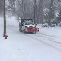
Click here for an updated story: Travel Restrictions Issued For DutchessTravel in Dutchess County may be restricted on Wednesday afternoon as the worst of the winter weather is expected to hit the Hudson Valley.Dutchess County remains under a Winter Storm Warning, which will be in effect until 7 a.m. on Thursday morning. Light snow fell in the region during the morning, which steadily ...
-
by
Kathy Reakes
Breaking News
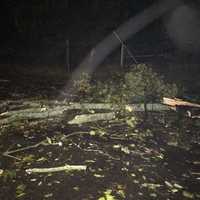
With another monster storm on the way, the Greenwich Police Department is reminding residents to use care when driving or around electrical lines.Storm clean-up and recovery continues and as of 8:30 a.m. Tuesday, the full road closure count in the Town of Greenwich was down to 14, police said.Utility companies continue to work to remove down lines and restore service to affected areas. ...
-

by
Joe Lombardi
Weather
As a powerful Nor'easter takes aim on the region, the latest projections show higher than previously expected snowfall totals for areas farther.Here's a rundown of what to expect by county.Westchester, Rockland, Southern Fairfield:Wind Advisory from 11 a.m. Friday to 6 a.m. Saturday, Flood Watch from 6 a.m. Friday to 6 a.m. Saturday. Rain before 2 p.m. Friday, then rain and snow with a ...
-

by
Joe Lombardi
Weather
List of school closures, delays in Hudson ValleyList of school closures in Fairfield CountyList of school closures, delays in Bergen, Passaic countiesHere's the latest update on the latest winter storm moving through the area Wednesday morning through the afternoon.Winter Weather Advisory for Northern Westchester, Putnam, Rockland, Dutchess, Northern Fairfield, Western Bergen County, ...
-

by
Joe Lombardi
Weather
This story has been updated.A changeover of rain to snow overnight could make roads slick during the Friday morning commute.Rain will change to a wintry mix around midnight, followed by snow showers and snow as the overnight low dips to the mid-20s. An inch or less of accumulation is possible.The chance for snow will end around 9 a.m. Friday. Skies will gradually clear with some sun in ...
-

by
Joe Lombardi
Weather
The bit of snow expected overnight Monday into Tuesday is just a small preview of what's expected later in the week when a more significant storm is expected.Scattered rain and snow showers Monday afternoon and evening will turn to all light snow showers overnight, with minimal accumulations of a coating or so possible.Tuesday will be mostly cloudy day with a high in the mid-30s. Sun ...
-

by
Joe Lombardi
Weather
Live Updates: School Closure Announcements For WednesdayThe storm system moving through the area overnight Tuesday into Wednesday is turning out to be pretty complicated.Early Tuesday night, the National Weather Service dropped Winter Weather Advisories across New York City and Southern Westchester, coastal Connecticut and portions of Northeast New Jersey as warmer air is expected and a ...


